November 2026
M T W T F S S
 1
2345678
9101112131415
16171819202122
23242526272829
30  
  • Ode To A Sleep System

    (Or: How I Learned To Stop Worrying And Love The Snowpocalypse)
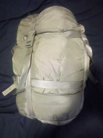
    I recently bought a sleeping bag so I can start breaking it in for next year. There was never any question for even a second about what type of sleeping bag I would get. I purchased a surplus 5-piece Army modular sleep system (MSS). I’ve never owned a sleeping bag that was as comfy, warm, and easy to quickly get packed as the one the Army issued me for free. I’d like to reminisce fondly about one particular occasion where it performed admirably in a way that would have gotten it an MSM if it was an Officer. Or a hearty handshake if it was an Enlisted man.

    That occasion was the epic snow and ice storm of February 2021. For those of you that weren’t living in central Texas for that fateful event, I’ll do my best to set the mood. It was a frigid President’s Day weekend and the Daytona 500 was on TV Sunday. Due to weather delays (which are all too common in Daytona in February) the race did not end until late. This was the race that was more famous for an epic final lap wreck than for the fact that Michael McDowell actually took the checkered flag. Once the race ended I turned off the TV and went to bed.

    Weather reports for the last week had stressed how bad the incoming storm was going to be. Almost everyone I knew took the reports seriously, but the problem was that the city was woefully unprepared. While I slept into Monday all hell broke loose. Temperatures stayed bitterly cold and snow and ice piled up on trees. Those trees couldn’t handle the extra weight and crashed or broke, taking power lines down with them. My apartment complex lost power for this reason.

    After action reports showed that experts from northern cities were baffled that Austin did so little tree maintenance in advance of the storm. In the city’s defense, there are almost never ice storms here. No one knew any better.

    The lack of power meant apartments would not stay warm. As a pre-emptive measure the management company turned off everyone’s water overnight. This ultimately saved us some broken pipes, but since water mains further upstream burst we would not have had water anyway. It did save my landlord some water damage bills though, and isn’t that what’s really important?

    When I awoke Monday I found that my power and water were both out. With nothing to do, I went traipsing around the area where I was living at the time. Along Metric Ave north of the Celis Brewery. It was just like a winter wonderland and every place I passed by was closed. I finally came upon an open gas station up near ACC Northridge. They had a line of cars as far as the eye could see and customers had bought all of the foodstuffs off the shelves except for some jellybeans and a few energy drinks. Pretty much my entire day was spent wandering around until I came back home and realized I was also out of foodstuffs. I ate one MetRx protein bar and decided to go to bed.

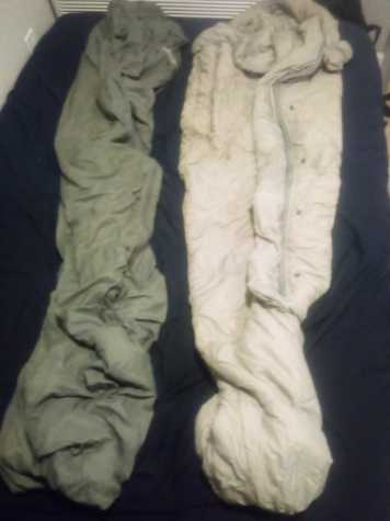
    With no power it was cold as shit. It was also pitch black after 6pm. Therefore I pulled out my trusty military issue sleeping bag and crawled into it for the night. The genius of the MSS was that there were two separate bags, one thin (left below) for moderate temperatures and one thick for cooler ones. For really extreme cold weather, you could put the thin bag inside the thick bag like a cocoon.
    To say it kept me warm was an understatement. I spent the entire night nice and toasty except for when I had to get up and pee into a toilet that I had no ability to flush. I figured I’d wait to fix that problem until I had to, like in the morning when I’d probably have to take a shit.

    Day two the temperature was still well below freezing so no ice was melting. The morning low was 7 degrees. Since there were zero road clearing vehicles in Austin the only people brave enough to venture out were truck drivers with snow chains and stupids who were accidents waiting to happen. Our apartment building had a pool that we all started taking buckets full of water from to flush our toilets. Little Caesars not far away had their power on somehow and employees actually came in, so I was able to have a Hot N Ready pizza instead of worrying about starving to death. At sundown I crawled back into my sleeping bag and ticked off another day.

    By day three it started warming up enough for ice to melt and crews were able to start fixing the utilities. That afternoon was the first time the temperature exceeded 32 degrees in over 140 hours. Those of us in the apartment complex could supplement the pool water with ice melt to keep our toilets flushed. And that night I crawled back into my sleeping bag and tried to remember what life was like with electricity and running water.

    On Thursday I got my power back, which meant I could work from home again. It also meant I could run my heat so it didn’t feel like I lived inside a walk-in cooler. Most importantly, it meant I could finally watch the news and surf the internet to understand the severity of this storm and its aftermath. People died frozen in their homes. Families got hit with catastrophic electric bills due to surge pricing. Lots of people were having it way worse than me. I still had a roof over my head, power, and access to Little Caesars. However, I still slept in the same sleeping bag because I had no water and had not washed myself in almost a week.

    Water was not soon to return either. As the weekend dragged on we stayed bone dry. Alternative water sources also became harder and harder to come by. The pool got emptied and all the snow melted.

    Things got so bad that come Monday we actually had a local non-profit deliver a pallet-sized water container into our parking lot. Everyone used it to fill buckets and pots and pans and tumblers with precious, precious H2O. Then a couple of days later we had another delivery of these cardboard, rectangular solid, single-serving containers of water from another non-profit. It legitimately felt like we lived in a refugee camp for a while. And the whole time all we, the tenants, could do was think of why dropping off all this water was easier than just fixing the burst pipes.

    Lo and behold, on Thursday afternoon, after almost two weeks our water got turned on. The long, hot shower I took two minutes later was well inside my top ten showers ever taken. After I logged off from work I took another just because it felt so good.

    Taking that shower meant I needed to finally stop using my sleep system. I’ll never forget how it saved my buns and kept them warm while the state of Texas froze. When I retired I had to turn it back in with the rest of my gear. I just hope this new MSS can provide me some small amount of the comfort my old one did. And I hope nothing remotely like 2021 happens again this winter.

    Oh, and by the way, the cheap ass landlord never did refill that pool the entire time I stayed at those apartments until spring 2023.
  • How to Navigate Without GPS or a Compass

    Here is something that is tangentially related to hiking. Do you have any idea how to find your bearings and direction if your compass and GPS stop working? Obviously you can, because people did just that long before compasses and GPS were a thing. Polynesian seafarers successfully navigated the open Pacific 5000 years ago. That was way before Waze.

    Here I’ll provide some tips that should help you survive in the worst possible hiking scenario: you get totally lost and have no power or compass. None of these methods will drop a giant pin where you need to go, but they will keep you alive if used correctly.

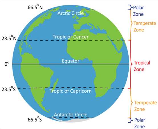
    Before we start I want to go over some terminology you will need to understand in order for these lessons to make any sense. Firstly, the Earth is a sphere. Sorry flerfs. The equator goes around the middle of the earth and divides it into northern and southern hemispheres. North America, Europe, the Middle East, and continental Asia are all entirely located within the northern hemisphere. Australia, Antarctica, almost all of South America, and about a third of Africa are in the southern one. If you are familiar with African geography, Lake Victoria sits just about right at the equator.

    Lines of latitude run east-west and divide the earth. The equator sits at 0 degrees latitude with the north and south poles at 90 degrees north and south respectively. 23.5 degrees north of the equator is a line of latitude called the Tropic of Cancer. Similarly, the Tropic of Capricorn sits at 23.5 degrees south latitude. The region between them is unsurprisingly called the tropics. The other important lines of latitude are the Arctic and Antarctic Circles, sat at 66.5 degrees north and south respectively. Everything north of the Arctic Circle or south of the Antarctic Circle is called polar regions. Everything between the tropics and the polar regions is known as the temperate region. Although I’m not sure how many people would describe Duluth, MN in the winter as “temperate”.

    Image shamelessly borrowed from https://www.climatechange.edu.hk

    Thanks for bearing with me on that. It is important because some of these methods will or won’t work in certain regions because of spherical geometry. There are also quite a few cases where you’ll need to do something one way in one hemisphere and then do it “backwards” in the opposite one.

    Generally speaking the best conditions in which to have no idea where you’re at are clear, sunny days. Barring that, the next best thing is a cloudless night with as many stars visible as possible. The worst conditions are overcast days and nights. This makes sense since the main ways to orient yourself involve using the sun and prominent stars. With that in mind, we’ll go over tips that you can use when conditions vary from best to worst.

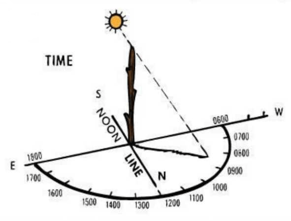
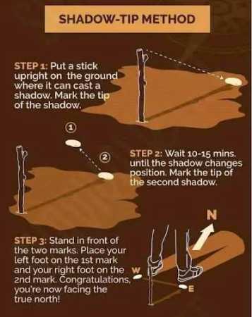
    First up is the shadow tip method. This works during the day and you only need enough sun to be able to cast a shadow, even if it is a faint or intermittent one. Place a stick vertically into the ground and put a small rock where the end of the shadow falls. This is your WEST. Wait patiently for 15 minutes or so until the shadow has moved a few inches and then place another rock on the new shadow tip. This is your EAST. Draw a line between the two rocks. Stand with your left foot on the west rock and your right foot on the east rock. Straight ahead is NORTH and behind you is SOUTH.

    You can draw a north-south line perpendicular to your east-west line. Put a second stick vertically into the ground at the intersection of those lines. Cant the stick slightly towards north in the northern hemisphere or towards south in the southern hemisphere. Draw a semicircle going from 0600 in the WEST to 1800 in the EAST. The shadow of that second stick will give you a rough approximation of the current hour. This method is more accurate the closer it is to noon and the closer you are to an equinox.

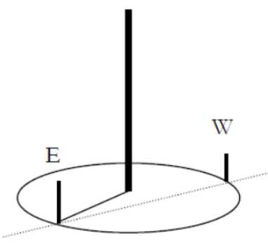
    There is an advanced version of the shadow tip method called equal shadow method. For this to work, you need to begin within ten minutes before solar noon (when the sun is at its highest point). Just like before you put a stick in the ground, but you need to make sure the shadow it casts is no more than 12 inches long. Mark the tip of the shadow with a rock; this will represent WEST again. Using a piece of string, trace a circle around the stick with radius equal to the length of the shadow.

    As noon approaches, the shadow will decrease in length and then start to increase again. Mark where the shadow touches the circle again; this is EAST. From here you can discern NORTH and SOUTH the same way as before.

    Pilfered from Scout Society

    Equal shadow method is more accurate than shadow tip, but at the cost of taking longer, using an extra piece of string, and needing to be done at a certain time of day. Both shadow tip and equal shadow can be done anywhere on earth, but they are much less reliable in the polar regions due to the position of the sun in the sky.

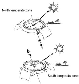
    Maybe you don’t like sticks. Then this next method is for you. It is called the watch method. You need to be able to read an analog clock face, which might eliminate any readers under the age of 35. If you do not have a watch, you can draw a picture of a watch showing the current time so you still need to know the exact time. One last thing is you need to be using standard time, so if you are on daylight savings then move the watch back one hour.

    This is hemisphere dependent. If you are in the northern hemisphere, take your watch or picture of the clock face and aim the hour hand at the sun. Midway between the hour hand and 12 will be SOUTH. If you are in the southern hemisphere, point 12 at the sun. Midway between 12 and the hour hand will be NORTH. This method requires you to be able to see the sun and only works in the temperate zones.

    Next up, let’s go over what you do during the roughly 50% of the time that there is no sun. At night your best friends will be the North Star and the Southern Cross.

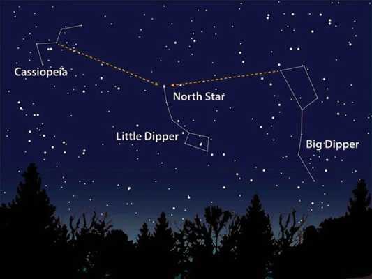
    The North Star (Polaris) is a part of the Little Dipper (Ursa Minor) constellation and always sits in the direction of NORTH. A good way to find it in the night sky is to remember that it sits as many degrees above the horizon as degrees you are above the equator. For example, at the north pole Polaris is directly overhead (90 degrees) and at the equator it sits right on the horizon (0 degrees). In Austin you can find it about 30 degrees above the horizon, or a third of the way up. Once you find the North Star you can use it to orient yourself and find the other cardinal directions.

    This picture was horked from Moab Happenings

    The Southern Cross (Crux) is a constellation seen only in the southern hemisphere. But if you’ve ever seen the Australian flag you know what it looks like. Fortunately, it contains four of the brightest stars in the southern hemisphere. Now it would be very simple and elegant if I could tell you something like how the Southern Cross sits exactly at south the same way Polaris sits at north. Sadly, this is anything but simple and elegant.

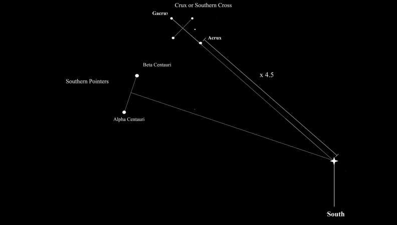
    To find south using the Southern Cross you have two options. First, you can extend the long axis of Crux out for another 4.5 lengths and that will end above south. If you don’t want to do that, you will need to find another constellation called Centaurus. Two stars in Centaurus (Alpha and Beta Centauri) can be used as pointer stars. Draw an imaginary line segment between those two stars. Extend a perpendicular line from the midpoint of that segment; where it crosses the extended long axis of Crux will be SOUTH.

    We lifted this from https://blog.woodland-ways.co.uk while they weren’t looking

    Like I said, this method is anything but simple and elegant. For the sake of simplicity, try to get hopelessly lost at night in the north if you can. Both of these methods work in any region but the constellations are tougher to see the closer to the equator you are. Also, you should stop and recalibrate often, especially in the southern hemisphere.

    The next nighttime navigation method requires more materials but does not require you to identify any stars or calculate the lengths of any major axes. It also works the same way in both the northern and southern hemispheres. This method is called LURD, which stands for Left Up Right Down.

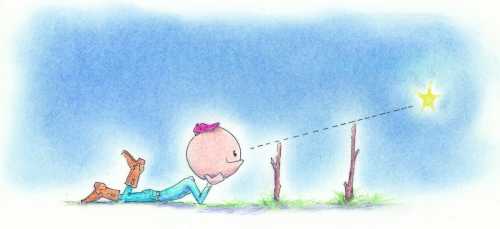
    You identify a star, pretty much any star except Polaris. Place a stick vertically into the ground so that its tip is at eye level while seated. About 2 feet or so is an ideal stick length. Pick your star of interest and line it up so it is at the tip of the stick while you are seated. Now take a second stick, about 3-4 feet long. Line that stick up behind the first one so that the star is located on the tip of both sticks while you are seated.

    Illustration swiped remorselessly from https://www.grit.com

    Good. Now wait about thirty minutes. In that time, your star of interest will have moved. Figure out which way it moved and use LURD to figure out which way you are facing.

    • If the star moved LEFT, you are facing NORTH
    • If the star moved UP, you are facing EAST
    • If the star moved RIGHT, you are facing SOUTH
    • If the star moved DOWN, you are facing WEST

    If the star moved up and right, it means you are facing to the southeast. If it moved left and down, you are facing northwest. This method consumes a lot of time both in the waiting for the star to move and in setting up the two sticks correctly.

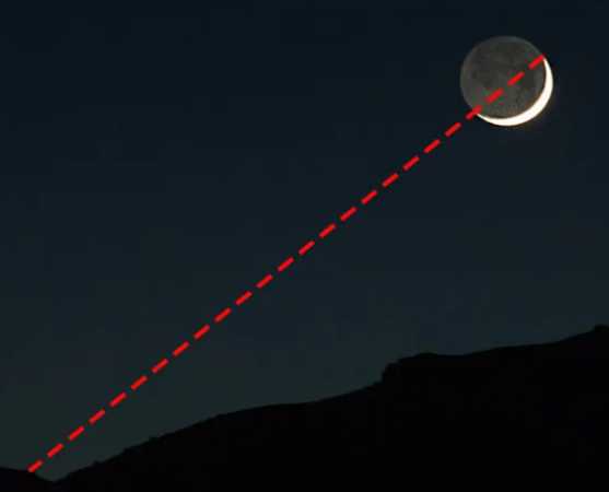
    There is one last method you can use on a clear night. This is called horns of the moon. This only works during a waxing or waning crescent moon, which is about one quarter of the time. Draw an imaginary line between the two tips of the crescent moon and extend that line down to the horizon. In the northern hemisphere, that point on the horizon will be SOUTH. In the southern hemisphere that point will be NORTH. Doesn’t work during a full moon for reasons that should be obvious.

    Now let’s look at what to do if it is too cloudy to see the sun or the stars. Your best bet is to use clues from nature. These are obviously going to lead to sub-optimal results, so anything you glean should be double checked as soon as you can get somewhere without cloud cover.

    Firstly, a “DON’T”. Don’t use the old wives’ tale about moss growing on the north side of trees. Moss is promiscuous and grows everywhere it feels like, as long as it gets enough sun. Seeing moss is not a reliable enough indicator of north to start trekking off in whatever direction it indicates.

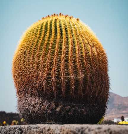
    In the early summer, north-facing hillsides will retain snow longer than southern facing ones in the northern hemisphere. In the southern hemisphere, the opposite is true. Tree stumps will have wider spaced growth rings on whichever side faces the equator. So, south in the northern hemisphere and north in the southern. Barrel cacti in the Mojave (southwestern USA) grow towards the south.

    Lastly, I’m going to discuss improvised compasses. I am going to talk about these last because I have the least amount of confidence in this method of finding your bearings. Basically, only try this if every single method listed above has proven ineffective. I have never gotten an improvised compass to tell me anything useful about which way anything was.

    You can magnetize a needle by rubbing it with a magnet or, barring that, a piece of silk or fur. You will need to rub the needle at least 50 times in the same direction in order to magnetize it. Then you will want to carefully lay the magnetized needle on top of a leaf in a puddle or pool of water. If you wait, the needle will align itself along a north-south line.

    For obvious reasons, the puddle or pool needs to be as far removed as possible from any metallic or magnetic items like cars, camping gear, bleachers, or the magnet you used to magnetize it in the first place. Again, I have never gotten this to work for me. But if you are so desperate you got all the way to this part of the post, you might as well try it.

    One last thing. I used some pictures here that I got from ATP 3-50.21, an Army Training Publication that is freely available to the public. It has to do with survival in all sorts of conditions and I’d recommend downloading it. Doubly so if you plan to find yourself in an Alive or The Mountain Between Us type situation.

  • Kryptonite Foods

    I am hoping to lose some weight as a side benefit of this thru-hike training. However, there are a few items out there that are doing their level best to prevent that from happening. I’m not talking about the two-foot tall slices from Cheesecake Factory or the fudge variety pack from Buc-ee’s. Those are obviously bad for you. I’m talking about things I buy with the intention of not overdoing it, but then look down 20 minutes later and the entire bag / tub / carton is empty. Also foods that seem okay to enjoy in moderation but are really silent killers. Like how they told us cigarettes were back in the 1980s. I will take this opportunity to shout out the snacks and guilty pleasures that make my life taste so good and my man boobs so soft and jiggly.

    DR PEPPER & CREAM SODA

    When these flavored Dr Pepper sodas first came out I openly scoffed and called it another unnecessary cash grab. I bought a bottle at a nearby 7-11, more because there wasn’t anything else I wanted than because I actually wanted one. Once I had my first sip though, I knew I was hooked for life.

    Something about the the flavor combo of Dr Pepper with cream soda is exactly what my taste buds crave. It also might be the fact that there are 39 grams of sugar in every 12 ounce can. At 150 calories each, these things are literally devastating to any diet. I can blow through 600-900 calories in a half hour just from these things. I try to never buy the 12 packs because I consume them too quickly.

    HEB MEXICAN STREET CORN TORTILLA CHIPS

    First of all, yes I am aware that they changed the packaging on these recently. But this is the packaging they had when I fell in love so I’ll always represent the O.G. version. Since this is a local Texas brand, most of you will never get to taste these. Trust me when I say the secret is that they taste exactly like street corn. I first had elote in 2014 while I was living in Las Vegas and immediately felt like I had wasted the first 38 years of my life.

    One serving of these chips has 170mg of sodium, which is 7% of the recommended daily allowance. This doesn’t sound too bad until you realize that one serving is only ten chips. No one eats ten chips and stops, especially when they taste like this. The entire bag is 70% of your recommended sodium and 110% of your recommended fat intake. And HEB loves to do coupons to encourage buying two or more bags at a time. I am highly susceptible to encouragement.

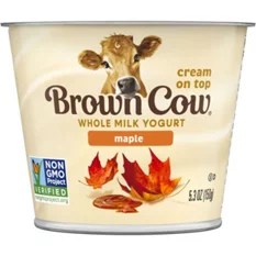
    BROWN COW MAPLE VANILLA YOGURT

    If you have never eaten Brown Cow yogurt, I feel genuinely bad for you. Please go buy some at your local supermarket and then come back and finish reading this. I’ll wait.

    That was great wasn’t it? The cream on top is so gooey and delicious and sweet. I like to mix it in with the rest of the yogurt, but eating it separately is totally allowed. Okay, now I need a minute to go have one myself.

    The hidden danger of this yogurt is added sugar. Total sugar is 16 grams, with added sugars accounting for 10 of those grams. This represents 20% of what scientists say you should have. But what do scientists know? Actually, they know pretty much everything about the natural world.

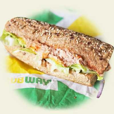
    SUBWAY TUNA SALAD FOOT-LONG

    People love to hate on Subway nowadays because the foot-long subs don’t cost $5 the way they used to 25 years ago. As though it is okay for every other consumable to increase in price, but not for subs with catchy jingles.

    I still go to Subway fairly frequently, and when I do I almost always get the tuna salad sub. I make tuna salad at home, but when I do I substitute cottage cheese instead of most of the mayo. Subway doesn’t substitute anything. It is chock full of mayo and umami goodness. Then you can have the sandwich artist add globs of additional mayo right before they close it up.

    The six inch tuna salad sub has 570 calories and 33 grams of fat. Mayo by itself adds 100 calories and 11 more grams of fat. This is all very depressing information.

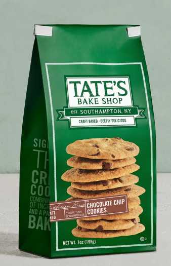
    TATE’S BAKE SHOP CHOCOLATE CHIP COOKIES

    These are the best cookies you can buy at every single Ross Dress For Less or Burlington Coat Factory. Or Marshalls. As a group, those and other similar places are called “off-price retailers”. I have no idea why you can find these cookies at those places, but I’m glad because I frequent off-price retailers often when I need new underwear or outerwear.

    It must be the high fat content that makes these so good. Two cookies contain 23% of the recommended daily allowance (RDA) of saturated fat. Good thing an entire bag has only fourteen cookies, I guess. Of course, one big selling point on these things is that they are from tony Southampton, New York. So eating just one gets me 100% of my RDA of smug.

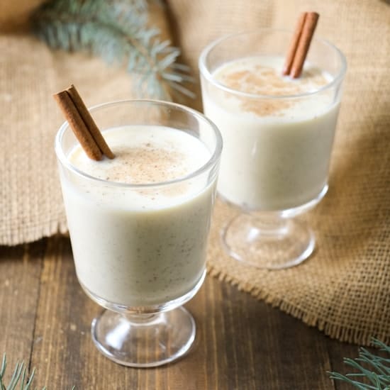
    EGG NOG

    Saving the most decadent for last. This is the only kryptonite food that doesn’t have a specific brand. That’s because I am equally vulnerable to all brands of egg nog. Every year I patiently wait until just before Thanksgiving and then begin my ritual of buying at least one quart of egg nog every Saturday morning. I rush home and then have one pint. Then I sit at home trying to stop thinking about the fact that a whole ‘nother pint of creamy, delicious egg nog is sitting right there in my fridge begging me to drink it. Usually by Saturday evening that second pint is also gone. I just thank my lucky stars that I never see egg nog sold in gallons.

    Last year Dairy Queen had a holiday nog shake for the holidays. I was there so many times they started yelling out my name when I walked in like Norm from Cheers.

    Looking at nutritional labels on egg nog is enough to make you cry. One serving has around 200 calories, which is a fuckload for a beverage. But a serving is one half of one cup. For those of you who only use metric, that means one pint (~475 mL) of the stuff is roughly 800 calories. One measly pint. I think that is all the information you need to be able to figure out whether or not I have trouble keeping weight off during the holidays.

  • Butler Bike Trail

    When a person from outside the Austin area thinks of Austin, they likely think about all of the sights you can find along the Butler Bike Trail. The kinds of spectacular shots of identifiable downtown landmarks you’d see in a show of the CSI/9-1-1/FBI -insert-your-city-name-here ilk, if there was such a show based in Austin. Wait a minute, there was a show called 9-1-1: Lone Star that was based in Austin. Their opening credits must have shown exactly the kinds of sights I’m thinking about. Let’s see that open.

    Okay. Never mind. That was pretty limp. If 9-1-1: Lone Star actually had an opening, it would show you the sort of things you think of when you think of Austin. And all those things can be seen along the Butler Bike Trail. Just trust me on this. So I threw on the backpack and went lakeside to check it out.

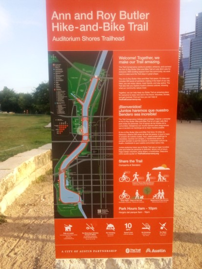
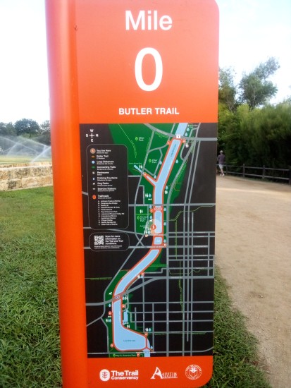
    Butler Bike Trail (officially the Ann and Roy Butler Hike-and-Bike Trail and Boardwalk At Lady Bird Lake — which rolls off the tongue) is a ten-mile loop along Lady Bird Lake between MoPac and Pleasant Valley Road. I went downtown and picked up the trail at mile zero near Auditorium Shores and hiked in the preferred clockwise direction because my OCD wouldn’t let me complete the loop in any other way.

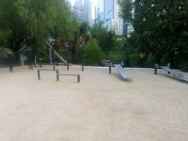
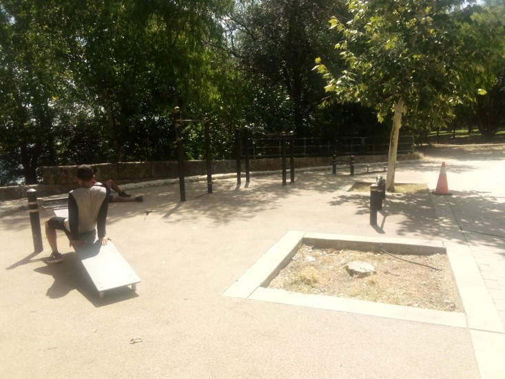
    Almost exactly at the beginning I encountered my first outdoor fitness area. A decent enough spot with some pull-up bars, push-up bars, and abdominal exercise stations. It also had good sized trees nearby to provide some shade in midday.

    The keen-eyed among you will notice the Bird scooter on the left side of the picture above. I had to include that in the shot since I am now an amateur birdwatcher.

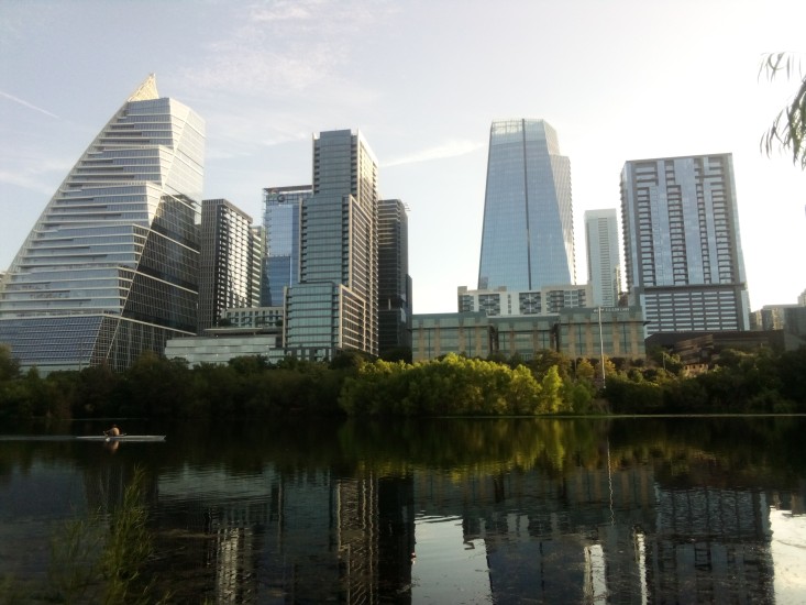
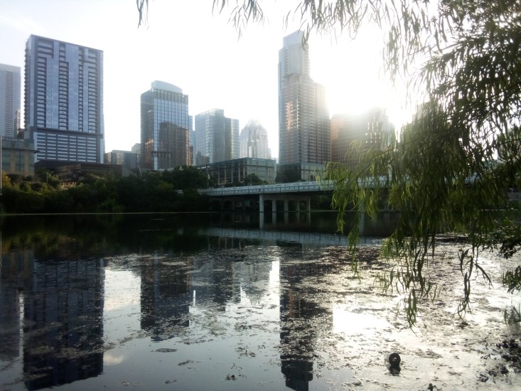
    Before I got too far into the trail, I had to take some shots of downtown. Since Austin is a city on the grow, most of what you see in the skyline is exceedingly new. In the picture on the left you can see Sail Tower on the far left; it looks like a sail. Moving right, you have Northshore, which is a high-end apartment building that looks like stair steps. On the right in the first picture and the left in the second picture is the W Hotel Austin. I’ve been on the roof there before. The views were nice and all but beer tasted the same as it does on ground level, and it’s much cheaper on the ground.

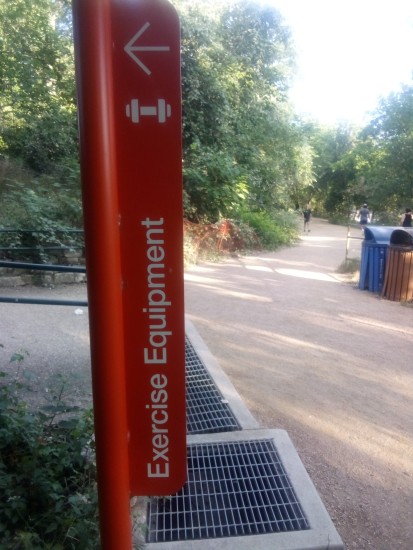
    Just under one mile into the trail I saw a sign for some exercise equipment just off the path. Of course I had to investigate.

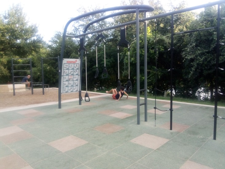
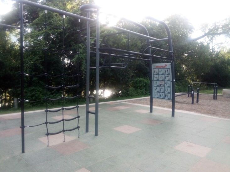
    Not 100 yards off the trail I found another fitness area. Two in less than one mile!

    And was that a Swedish ladder I saw along with some rings, a dip station, rope ladder, and suspension trainers? Be still my heart! It had only been one mile, but so far this was the single greatest trail in the entire United States of America. The only thing that could have made this better would’ve been a stand with free beef jerky.

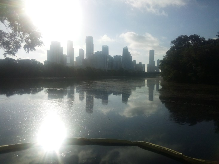
    Sadly, there was no beef jerky. I soon made my way to Lou Neff Point. The location is named for Barbara Louise Neff, who was a civic leader and held many positions with multiple entities such as being President of Austin High School PTA and Heritage Society. Lou Neff Point is a scenic vista where I got another good shot of downtown, although Mister Sun did his best to spoil the shot.


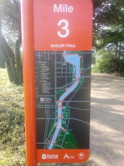
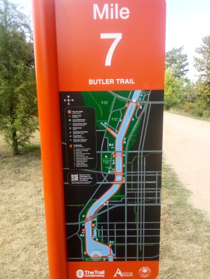
    The next couple of miles were uneventful. Just hiking along the shore, watching people, crossing over and under bridges. Spider webs covering almost everything. Notice how once I crossed over the MoPac bridge the maps on the mile markers flipped over. Not sure why that was necessary.

    Near the Central Library, I got a great look at two particularly photogenic Egyptian geese. I have to include a shot of them here since I am an expert birdwatcher.

    Egyptian geese are an invasive species that are not native to Texas. They are easily identified by the big brown spots around their eyes and colorful back feathers. They are also known to be aggressive when defending their area, to the point of trying to fight off drones. The two I saw were pretty chill and basically ignored me. They may have still been salty about their team blowing that lead against Argentina.

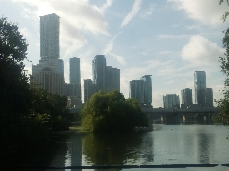
    Here is another shot of downtown that shows off a few different buildings. That super tall tower on the left is Waterline, Austin’s tallest building and her first to break 1000 feet. The buildings on the right are all part of the Rainey Street district. These include the tallest one on the right, which is 44 East.

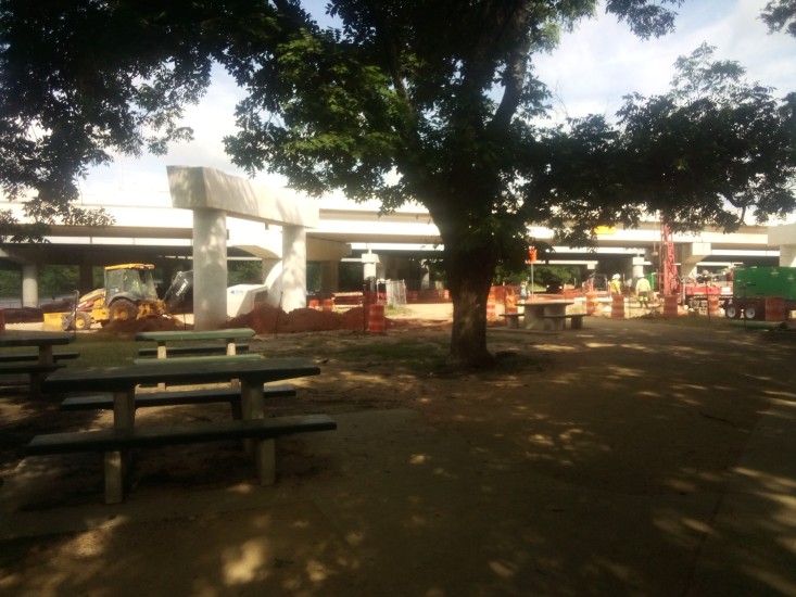
    Between mile 5 and 6 I crossed under I-35 for the first time. While there I took some time to admire the never ending construction while resting on some park benches.

    Major construction of roadways always reminds me of the Big Dig. If that name sounds sort of familiar to you, but you aren’t sure why, that was the colloquial name given to the public works project that buried I-93 underneath Boston. This was in the nineties and early 2000s. It was contentious because it was largely paid for with federal government money. Meaning some guy in Iowa was getting hit with the tax hammer so some people in some place he had never been could get their city beautified. As someone who hates spending tax money and beauty, I always thought it was unfair for the Big Dig to be funded in such a way. Especially since delays and design flaws ballooned both the cost and the timeline.

    However, as someone who lived in Boston during and after the Big Dig, I have to say it was the most significant and positive change that occurred in The Hub the whole time I was there. It literally took a town that was cut in half by the elevated highway and stitched it back together into a walkable, pedestrian friendly city. It salvaged a mishmash of ancient streets that could not handle modern traffic and at least gave commuters a fighting chance to get home from work before bedtime. It also gave us the Zakim Bridge, which is exactly the kind of landmark you see on TV when they need to tell you their show is set in Boston.

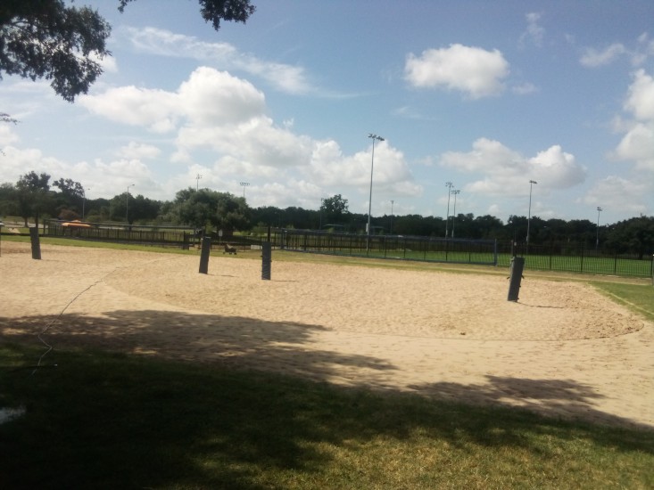
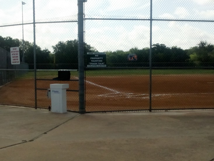
    These old legs needed another break after mile 6, so I wandered just slightly off the trail at Longhorn Dam / Pleasant Valley Road and entered Krieg Athletic Complex. I ate a turkey and provolone sandwich and Great Value key lime yogurt that I had packed myself and then checked out the park. There were probably over a dozen softball fields as well as turf fields and volleyball fields. Lots of space for recreation and whatnot.


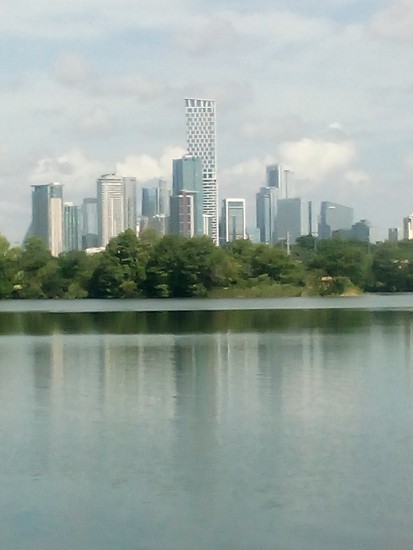
    The mile marker maps flipped back over again at mile 7, which meant I was getting close to the end of the sojourn. Here is one more shot of downtown from around that point on the trail. For those of you who want to know more about the diverse buildings of downtown, here is a good little story and quiz from our local NBC affiliate. For everyone else, I promise I will not mention the skyline again in this post.

    I was pleasantly surprised when I saw a third outdoor fitness station. This one was much like the first one, some pull-up bars and inclined ab locations.

    At this point I need to mention one extremely positive thing. Every single fitness station had a working water fountain. More than that, there were working water fountains all over the trail. And lots of working toilets spaced adequately so that it never seemed like you went more than a mile and change without coming across one. And the trail itself was as well kept as you could expect with thousands of yahoos like myself using it every day. Hats off to The Trail Conservancy and their Park Rangers and custodians and everyone involved with making sure that everything was in pristine condition. The effort was much appreciated.

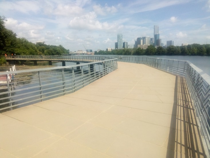
    The homestretch of the trail included the Boardwalk. This reminded me of the Esplanade in Boston. The Esplanade was always a good place to go for a run or catch an event at the Hatch Shell or play ultimate along the Charles. I haven’t lived in Boston for thirteen years, so it was strange to think about it twice in one morning. At least both memories were positive.

    Sadly, my time on the Boardwalk was not all positive. The major drawback was that there was zero overhead cover from mean old Mister Sun. And it was a hot day. Everywhere else on the trail had access to a fair amount of tree cover and shade, but the Boardwalk had none of that. I’m not sure who made that decision, but it was an interesting choice. It definitely made me speed walk the end of my hike to get it over and go somewhere cool.

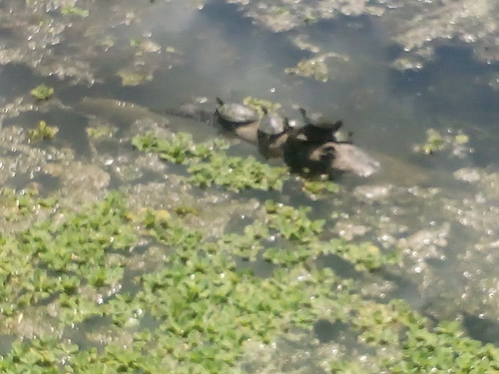
    I have one final picture that didn’t really fit in anywhere else in my story, but it needs to go somewhere. Here is a shot of four turtles on a log in the lake. Why are they there? What are they doing? Don’t know, don’t care. Enjoy.